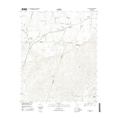
2014 Map of Taylorsville
USGS Topo · Published 2014About this map
Taylorsville and Stilesboro anchor this map of Northwest Georgia, where the land transitions from the fertile valley of Euharlee Creek into the high ridges of Pine Mtn. The 2014 survey reveals a landscape steeped in family and religious history, marked by numerous burial grounds like the Old Salem Graveyard and Sproull Family Cem. A significant topographical feature, Iron Stab, sits near the triple-point intersection of Bartow, Polk, and Paulding counties. The southern portion of the map is defined by the complex drainage of the Pegamore system, including Pegamore Lake and Night Prong Pegamore Cr. These waterways and the presence of numerous small church-affiliated cemeteries, such as the Shiloh Missionary Baptist Church Cem, reflect a pattern of rural settlement and local congregation that has endured into the twenty-first century.
Find a feature on this map
92 named features on this map. Tap any name to fly to it.
Don’t see what you’re looking for? This feature index may not catch every label — zoom into the map to look around manually.
Map Details
Editions of this 2014 Taylorsville Map
This is the sole edition of this map. No revisions or reprints were ever made.
Other maps of this area

1886 · Rome
USGS Topo · 1:125,000

1889 · Tallapoosa
USGS Topo · 1:125,000

1890 · Cartersville
USGS Topo · 1:125,000

1891 · Marietta
USGS Topo · 1:125,000

1891 · Cartersville
USGS Topo · 1:125,000

1892 · Tallapoosa
USGS Topo · 1:125,000

1895 · Marietta
USGS Topo · 1:125,000

1896 · Cartersville
USGS Topo · 1:125,000

1897 · Marietta
USGS Topo · 1:125,000

1897 · Tallapoosa
USGS Topo · 1:125,000