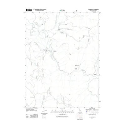
2012 Map of Taylorsville
USGS Topo · Published 2012About this map
Taylorsville sits at the confluence of several vital waterways in Plumas County, serving as a focal point where Indian Cr meets Lights Cr and the drainage of the North Arm. The settlement pattern follows the fertile floor of Genesee Valley, connected by historical routes like N Valley Rd and Emigrant Rd. To the east, the community of Genesee marks a transition toward more elevated terrain, anchored by landmarks such as Mount Jura and the Hinchman Ravine. This 2012 survey illustrates the enduring relationship between these small mountain communities and the complex network of Forest Service roads, including Beardsley Grade and Walker Mine Rd, which navigate the steep ravines and peaks of the Sierra Nevada. Genealogists and local historians can locate the Shim Flat Cem near the valley floor and trace the historical boundaries of the Taylorsville Rancheria.
Find a feature on this map
54 named features on this map. Tap any name to fly to it.
Don’t see what you’re looking for? This feature index may not catch every label — zoom into the map to look around manually.
Map Details
Editions of this 2012 Taylorsville Map
This is the sole edition of this map. No revisions or reprints were ever made.
Other maps of this area

1886 · Honey Lake
USGS Topo · 1:250,000

1891 · Downieville
USGS Topo · 1:125,000

1891 · Honey Lake
USGS Topo · 1:250,000

1893 · Honey Lake
USGS Topo · 1:250,000

1893 · Downieville
USGS Topo · 1:125,000

1895 · Downieville
USGS Topo · 1:125,000

1896 · Downieville
USGS Topo · 1:125,000

1897 · Downieville
USGS Topo · 1:125,000

1937 · Blairsden
USGS Topo · 1:48,000

1943 · Blairsden
USGS Topo · 1:62,500