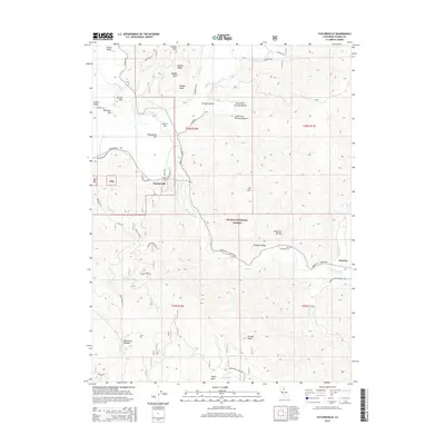
2015 Map of Taylorsville
USGS Topo · Published 2015About this map
Indian Valley and Genesee Valley serve as the primary topographical anchors in this Plumas County landscape, where the settlement of Taylorsville sits at the confluence of several vital watercourses. The drainage of Indian Creek dominates the hydrology, fed by numerous tributaries including Lights Cr, Hough Cr, and Montgomery Cr. The surrounding terrain is defined by prominent peaks and ridges within the Plumas National Forest, most notably Mt Jura, Keddie Peak, and Grizzly Peak.
Find a feature on this map
60 named features on this map. Tap any name to fly to it.
Don’t see what you’re looking for? This feature index may not catch every label — zoom into the map to look around manually.
Map Details
Editions of this 2015 Taylorsville Map
This is the sole edition of this map. No revisions or reprints were ever made.
Other maps of this area

1886 · Honey Lake
USGS Topo · 1:250,000

1891 · Downieville
USGS Topo · 1:125,000

1891 · Honey Lake
USGS Topo · 1:250,000

1893 · Honey Lake
USGS Topo · 1:250,000

1893 · Downieville
USGS Topo · 1:125,000

1895 · Downieville
USGS Topo · 1:125,000

1896 · Downieville
USGS Topo · 1:125,000

1897 · Downieville
USGS Topo · 1:125,000

1937 · Blairsden
USGS Topo · 1:48,000

1943 · Blairsden
USGS Topo · 1:62,500