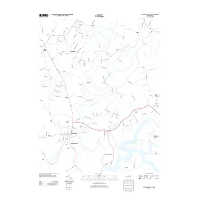
2013 Map of Taylorsville
USGS Topo · Published 2013About this map
The Salt River and its massive impoundment, Taylorsville Lake, dominate the southern landscape of this Spencer County quadrangle. The town of Taylorsville sits at the confluence of the river and Brashears Cr, a hub for local transportation and community life. The 2013 landscape shows a blend of aviation and agriculture, with both Willow Island Airpark in the north and Mason Valley Airport to the west serving the region alongside traditional agricultural operations like Bucks Creek Farm and Riverhill Farm. Small settlements and historic crossroads such as Normandy, Yoder, and Little Mount dot the countryside, connected by a dense network of local roads. The terrain is marked by distinctive features such as Horseshoe Bend and the prominence of Snyder Bluff, while the Valley Cem and Little Mt Cem provide important touchstones for local genealogical research.
Find a feature on this map
137 named features on this map. Tap any name to fly to it.
Don’t see what you’re looking for? This feature index may not catch every label — zoom into the map to look around manually.
Map Details
Editions of this 2013 Taylorsville Map
This is the sole edition of this map. No revisions or reprints were ever made.
Other maps of this area

1923 · Waddy
USGS Topo · 1:48,000

1925 · Mount Eden
USGS Topo · 1:48,000

1927 · Mount Eden
USGS Topo · 1:62,500

1929 · Taylorsville
USGS Topo · 1:62,500

1951 · Fisherville
USGS Topo · 1:24,000

1951 · Waterford
USGS Topo · 1:24,000

1952 · Chaplin
USGS Topo · 1:24,000

1953 · Bloomfield
USGS Topo · 1:24,000

1953 · Fairfield
USGS Topo · 1:24,000

1954 · Taylorsville
USGS Topo · 1:24,000