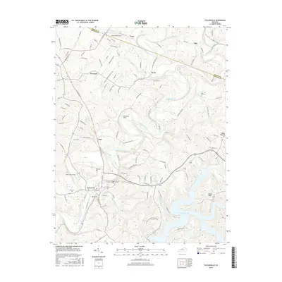
2016 Map of Taylorsville
USGS Topo · Published 2016About this map
The Salt River and its major tributary, Brashears Creek, define the landscape of this Spencer County region just south of the Shelby County line. In this 2016 survey, the northern reaches of Taylorsville Lake dominate the southeastern quadrant, formed by the impoundment of the river and flooding areas near Possum Ridge. The town of Taylorsville sits at the western edge of the reservoir, maintaining its position near the confluence of these historical waterways.
Find a feature on this map
110 named features on this map. Tap any name to fly to it.
Don’t see what you’re looking for? This feature index may not catch every label — zoom into the map to look around manually.
Map Details
Editions of this 2016 Taylorsville Map
This is the sole edition of this map. No revisions or reprints were ever made.
Other maps of this area

1923 · Waddy
USGS Topo · 1:48,000

1925 · Mount Eden
USGS Topo · 1:48,000

1927 · Mount Eden
USGS Topo · 1:62,500

1929 · Taylorsville
USGS Topo · 1:62,500

1951 · Fisherville
USGS Topo · 1:24,000

1951 · Waterford
USGS Topo · 1:24,000

1952 · Chaplin
USGS Topo · 1:24,000

1953 · Bloomfield
USGS Topo · 1:24,000

1953 · Fairfield
USGS Topo · 1:24,000

1954 · Taylorsville
USGS Topo · 1:24,000