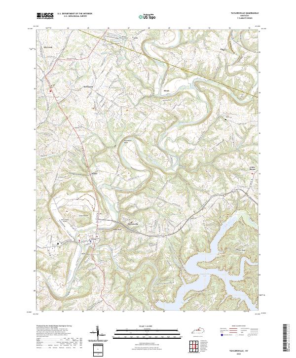
2022 Map of Taylorsville
USGS Topo · Published 2022About this map
Taylorsville serves as the focal point of this central Kentucky landscape, where the Salt River is impounded to form the sprawling Taylorsville Lake. The town layout remains centered on the Spencer County Courthouse, surrounded by historic thoroughfares like W Main St and Garrard St. To the north and west, the terrain is defined by smaller agricultural settlements including Normandy, Yoder, and Elk Creek, linked by a network of winding roads like Taylorsville Rd and Shelbyville Rd. The map illustrates a transition between traditional river-valley settlements and more modern recreational and residential developments near the lake. Notable landmarks such as Mason Valley Airport and Little Mount Cem provide clear points of reference for local historians, while the sinuous path of Brashears Creek cuts through the northern half of the sheet, creating prominent geographic features like Horseshoe Bend.
Find a feature on this map
63 named features on this map. Tap any name to fly to it.
Don’t see what you’re looking for? This feature index may not catch every label — zoom into the map to look around manually.
Map Details
Editions of this 2022 Taylorsville Map
This is the sole edition of this map. No revisions or reprints were ever made.
Other maps of this area

1923 · Waddy
USGS Topo · 1:48,000

1925 · Mount Eden
USGS Topo · 1:48,000

1927 · Mount Eden
USGS Topo · 1:62,500

1929 · Taylorsville
USGS Topo · 1:62,500

1951 · Fisherville
USGS Topo · 1:24,000

1951 · Waterford
USGS Topo · 1:24,000

1952 · Chaplin
USGS Topo · 1:24,000

1953 · Bloomfield
USGS Topo · 1:24,000

1953 · Fairfield
USGS Topo · 1:24,000

1954 · Taylorsville
USGS Topo · 1:24,000