
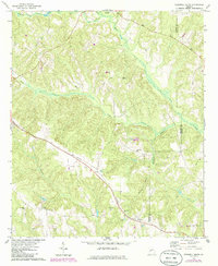
1971 Map of Tazewell South
USGS Topo · Published 1974About this map
The Central Of Georgia railroad corridor cuts a diagonal path through the rural landscape of Marion and Schley counties, anchoring the small settlements of Doyle and Putnam. In the early 1970s, this area remained defined by its intricate drainage networks, where the headwaters of Muckalee Creek and Oochee Creek carve through the terrain. The map reveals a deeply rooted community structure, evidenced by a high density of country churches and family burial grounds like Mahala Chapel, Mt Pleasant Ch, and New Hope Cem.
Find a feature on this map
25 named features on this map. Tap any name to fly to it.
Don’t see what you’re looking for? This feature index may not catch every label — zoom into the map to look around manually.
Map Details
Editions of this 1971 Tazewell South Map
2 editions found
Other maps of this area

1950 · Buena Vista NE
USGS Topo · 1:24,000

1950 · Buena Vista
USGS Topo · 1:24,000

1950 · Buena Vista
USGS Topo · 1:62,500

1955 · Buena Vista
USGS Topo · 1:24,000

1955 · Buena Vista NE
USGS Topo · 1:24,000
1955 · Buena Vista
USGS Topo · 1:62,500

1955 · Phenix City
USGS Topo · 1:250,000

1957 · Phenix City
USGS Topo · 1:250,000

1958 · Phenix City
USGS Topo · 1:250,000

1971 · Rupert
USGS Topo · 1:24,000