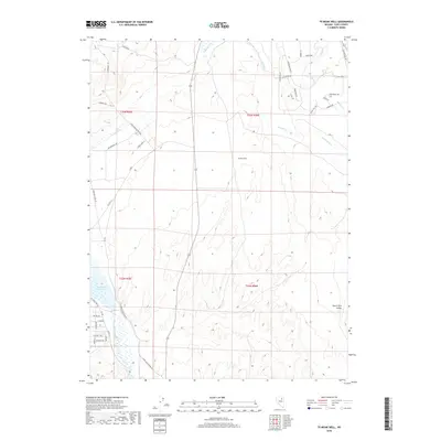
2018 Map of Te-Moak Well
USGS Topo · Published 2018About this map
Te-Moak Well serves as a central landmark in this high-desert landscape south of Elko, where the South Fork Humboldt River flows into the South Fork Reservoir. The topography is defined by the broad South Fork Valley and several seasonal watercourses including Tenmile Cr, Mitchell Cr, and Butterfield Cr. Historically significant transportation corridors cross the terrain, most notably the Emigrant Trl and the Elko Hamilton Stage Rd, tracing the movement of early travelers through the Great Basin. Modern residential developments are clustered in the southwest near NV State Park Rd, with street names like Patton Ave and Clark Ave marking a transition from the open range to more settled pockets. The map illustrates a landscape of intermittent streams and evolving rural infrastructure within Elko County.
Find a feature on this map
42 named features on this map. Tap any name to fly to it.
Don’t see what you’re looking for? This feature index may not catch every label — zoom into the map to look around manually.
Map Details
Editions of this 2018 Te-Moak Well Map
This is the sole edition of this map. No revisions or reprints were ever made.
Other maps of this area
1952 · Dixie Flats
USGS Topo · 1:62,500

1955 · Elko
USGS Topo · 1:250,000
1957 · Elko West
USGS Topo · 1:24,000
1957 · Elko East
USGS Topo · 1:24,000

1958 · Elko
USGS Topo · 1:250,000

1962 · Elko
USGS Topo · 1:250,000
1962 · Boyd Reservoir
USGS Topo · 1:24,000
1962 · Elko East
USGS Topo · 1:24,000
1962 · Elko West
USGS Topo · 1:24,000
1962 · Lee
USGS Topo · 1:62,500