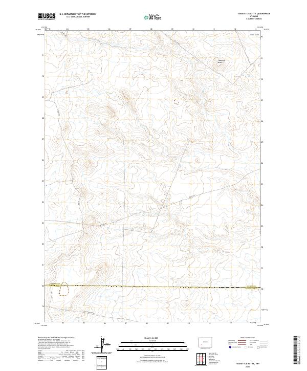
2021 Map of Teakettle Butte
USGS Topo · Published 2021About this map
The California-Oregon Trl cuts across the southern portion of this high-desert landscape, preserving the path of westward migration through Wyoming. This high-plateau terrain is defined by dramatic geological formations, most notably the prominent Teakettle Butte in the northeastern corner. The landscape is largely undeveloped, carved by intermittent drainages such as Jonah Gulch.
Find a feature on this map
16 named features on this map. Tap any name to fly to it.
Don’t see what you’re looking for? This feature index may not catch every label — zoom into the map to look around manually.
Map Details
Editions of this 2021 Teakettle Butte Map
This is the sole edition of this map. No revisions or reprints were ever made.
Other maps of this area

1955 · Lander
USGS Topo · 1:250,000

1958 · Lander
USGS Topo · 1:250,000

1961 · Lander
USGS Topo · 1:250,000

1968 · Twelvemile Knoll
USGS Topo · 1:24,000
1968 · Monument Butte NE
USGS Topo · 1:24,000
1968 · Fourmile Knoll
USGS Topo · 1:24,000
1969 · Sugar Loaf
USGS Topo · 1:24,000
1969 · Juel Spring
USGS Topo · 1:24,000
1969 · Teakettle Butte
USGS Topo · 1:24,000
1969 · Bull Draw
USGS Topo · 1:24,000