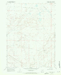
1968 Map of Fourmile Knoll
USGS Topo · Published 1971About this map
The Emigrant Trail traverses the arid landscape of Sweetwater County in this late 1960s survey, marking a corridor of historical westward movement. The map highlights the Sublette Cutoff, a vital branch for travelers seeking a more direct route through the High Desert. This segment of the trail system is accompanied by the Lincoln Sweetwater Road, showing the evolution of primitive paths into established thoroughfares. The terrain is defined by the broad expanse of Sublettes Flat and the winding course of Simpson Gulch. Standing as a prominent navigational landmark in the southern portion of the sheet is Fourmile Knoll, which provides a clear point of reference in an otherwise vast and open topography of alkaline flats and drainage basins.
Find a feature on this map
7 named features on this map. Tap any name to fly to it.
Don’t see what you’re looking for? This feature index may not catch every label — zoom into the map to look around manually.
Map Details
Editions of this 1968 Fourmile Knoll Map
2 editions found
Other maps of this area

1955 · Lander
USGS Topo · 1:250,000

1958 · Lander
USGS Topo · 1:250,000

1961 · Lander
USGS Topo · 1:250,000

1968 · Farson
USGS Topo · 1:24,000

1968 · Twelvemile Knoll
USGS Topo · 1:24,000
1968 · Eden Reservoir West
USGS Topo · 1:24,000
1968 · Simpson Gulch SE
USGS Topo · 1:24,000
1968 · Simpson Gulch SW
USGS Topo · 1:24,000
1969 · Juel Spring
USGS Topo · 1:24,000
1969 · Teakettle Butte
USGS Topo · 1:24,000