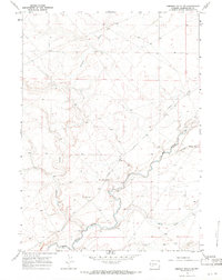
1968 Map of Simpson Gulch SE
USGS Topo · Published 1971About this map
The Big Sandy River meanders through this high desert terrain in Sweetwater County, serving as the primary geographical anchor for the region in the late 1960s. The landscape is defined by its arid drainage systems, including Simpson Gulch, Carlson Draw, and Bone Draw, which converge toward the river valley. A significant layer of western history is visible in the corridor where the Emigrant Trail traverses the map, marking the path of early pioneers. Modern infrastructure of the era is represented by the Lower Farson Cutoff road and a Gaging Sta on the riverbank, used for monitoring water flow in this crucial watershed. The presence of a Radio Tower and an extensive network of fence lines reflects the mid-century intersection of ranching operations and telecommunications development in this open range.
Find a feature on this map
12 named features on this map. Tap any name to fly to it.
Don’t see what you’re looking for? This feature index may not catch every label — zoom into the map to look around manually.
Map Details
Editions of this 1968 Simpson Gulch SE Map
2 editions found
Other maps of this area

1954 · Rock Springs
USGS Topo · 1:250,000

1955 · Lander
USGS Topo · 1:250,000

1958 · Lander
USGS Topo · 1:250,000

1958 · Rock Springs
USGS Topo · 1:250,000

1961 · Lander
USGS Topo · 1:250,000

1962 · Rock Springs
USGS Topo · 1:250,000

1963 · Gasson Bridge
USGS Topo · 1:24,000

1963 · Pittman Well
USGS Topo · 1:24,000

1968 · Farson
USGS Topo · 1:24,000

1968 · Twelvemile Knoll
USGS Topo · 1:24,000