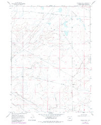
1968 Map of Fourmile Knoll
USGS Topo · Published 1980About this map
The historical (Sublette Cutoff) Emigrant Trail crosses the high plateau of Sweetwater County in this late-1960s survey. This portion of the Oregon Trail system provided a direct but water-sparse route for 19th-century pioneers, visible here as it traverses Sublettes Flat toward the western horizon. The arid landscape is defined by drainage features like Simpson Gulch and prominent landmarks such as Fourmile Knoll, which served as essential navigational waypoints in an otherwise uniform terrain. The emergence of modern infrastructure is marked by the Lincoln Sweetwater Road, which follows the general corridor of the traditional emigrant paths, illustrating how 20th-century transportation networks in Wyoming often reinforced the same east-west passages established during the era of westward expansion.
Find a feature on this map
5 named features on this map. Tap any name to fly to it.
Don’t see what you’re looking for? This feature index may not catch every label — zoom into the map to look around manually.
Map Details
Editions of this 1968 Fourmile Knoll Map
2 editions found
Other maps of this area

1955 · Lander
USGS Topo · 1:250,000

1958 · Lander
USGS Topo · 1:250,000

1961 · Lander
USGS Topo · 1:250,000

1968 · Farson
USGS Topo · 1:24,000

1968 · Twelvemile Knoll
USGS Topo · 1:24,000
1968 · Eden Reservoir West
USGS Topo · 1:24,000
1968 · Simpson Gulch SE
USGS Topo · 1:24,000
1968 · Simpson Gulch SW
USGS Topo · 1:24,000
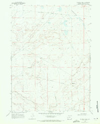
1968 · Fourmile Knoll
USGS Topo · 1:24,000
1969 · Juel Spring
USGS Topo · 1:24,000