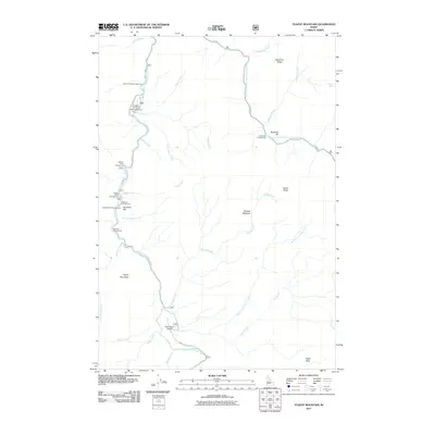
2011 Map of Teapot Mountain
USGS Topo · Published 2011About this map
The South Fork Salmon River and its tributary, the East Fork South Fork Salmon River, carve through this central Idaho landscape, creating a network of ridges and bars that defined local accessibility in the early 21st century. High-elevation points like Teapot Mountain and Eagle Rock overlook a backcountry largely reachable only by specialized infrastructure, including the Krassel-US Forest Service Airport and the Reed Ranch Airport. The mapping reveals a distinct pattern of seasonal activity concentrated along the riverbanks, evidenced by several established recreation sites such as Salmon Point Campground and the Buckhorn Bar Campground. Significant natural landmarks, such as Phoebe Meadow and Deadman Ridge, illustrate the complex drainage systems of Phoebe Creek and Deadman Creek as they flow toward the Salmon River canyon.
Find a feature on this map
38 named features on this map. Tap any name to fly to it.
Don’t see what you’re looking for? This feature index may not catch every label — zoom into the map to look around manually.
Map Details
Editions of this 2011 Teapot Mountain Map
This is the sole edition of this map. No revisions or reprints were ever made.
Other maps of this area

1956 · Elk City
USGS Topo · 1:250,000

1957 · Challis
USGS Topo · 1:250,000

1960 · Elk City
USGS Topo · 1:250,000

1960 · Challis
USGS Topo · 1:250,000

1963 · Challis
USGS Topo · 1:250,000

1969 · Enos Lake
USGS Topo · 1:24,000

1969 · Parks Peak
USGS Topo · 1:24,000

1969 · Williams Peak
USGS Topo · 1:24,000

1973 · Blackmare
USGS Topo · 1:24,000

1973 · White Rock Peak
USGS Topo · 1:24,000