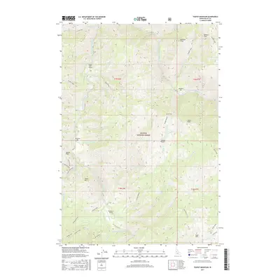
2017 Map of Teapot Mountain
USGS Topo · Published 2017About this map
Krassel USFS Airport and the Reed Ranch Airport serve as critical access points in this high-altitude reach of the Payette National Forest. This interior portion of Valley County is defined by the confluence of the South Fork Salmon River and its East Fork, where gravel bars like Deadman Bar and Buckhorn Bar sit deep within the drainage. The landscape is a network of sharp divides, including Sixmile Ridge and Indian Ridge, which separate numerous tributaries such as Fitsum Creek and Phoebe Creek. The presence of Miners Peak and Teapot Mountain suggests a history of high-country exploration and naming, while names like Nasty Creek and Deadman Creek hint at the difficult conditions faced by early travelers and foresters in these mountains.
Find a feature on this map
48 named features on this map. Tap any name to fly to it.
Don’t see what you’re looking for? This feature index may not catch every label — zoom into the map to look around manually.
Map Details
Editions of this 2017 Teapot Mountain Map
This is the sole edition of this map. No revisions or reprints were ever made.
Other maps of this area

1956 · Elk City
USGS Topo · 1:250,000

1957 · Challis
USGS Topo · 1:250,000

1960 · Elk City
USGS Topo · 1:250,000

1960 · Challis
USGS Topo · 1:250,000

1963 · Challis
USGS Topo · 1:250,000
1969 · Enos Lake
USGS Topo · 1:24,000
1969 · Parks Peak
USGS Topo · 1:24,000
1969 · Williams Peak
USGS Topo · 1:24,000
1973 · Blackmare
USGS Topo · 1:24,000
1973 · White Rock Peak
USGS Topo · 1:24,000