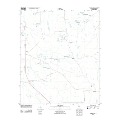
2011 Map of Teasleys Mill
USGS Topo · Published 2011About this map
Teasleys Mill serves as a focal point in this portion of Montgomery County, where the landscape is defined by its numerous small private reservoirs and named tributaries. The area around Carters Hill and Shepherd Hill is interconnected by a network of rural routes such as Hayneville Ridge Rd and Old Pike Rd. Small settlements like Mamie, Canty, and Downing are interspersed throughout the agricultural terrain, often situated near family-named lakes and dams. Water management is a significant feature of this environment, with structures like the W C Gray Dam creating Grays Lake and the T S Turnipseed Dam appearing near the southern edge. Local genealogy is anchored by established burial grounds, including Barnett Cemetery, Orange Cemetery, and Meriwether Cemetery, which stand as landmarks of the area's social history.
Find a feature on this map
55 named features on this map. Tap any name to fly to it.
Don’t see what you’re looking for? This feature index may not catch every label — zoom into the map to look around manually.
Map Details
Editions of this 2011 Teasleys Mill Map
This is the sole edition of this map. No revisions or reprints were ever made.
Other maps of this area

1953 · Montgomery
USGS Topo · 1:250,000

1955 · Phenix City
USGS Topo · 1:250,000

1956 · Montgomery
USGS Topo · 1:250,000

1957 · Phenix City
USGS Topo · 1:250,000

1957 · Montgomery
USGS Topo · 1:250,000

1958 · Phenix City
USGS Topo · 1:250,000

1958 · Mount Meigs
USGS Topo · 1:62,500
1971 · China Grove
USGS Topo · 1:24,000
1971 · Fitzpatrick
USGS Topo · 1:24,000

1971 · Davis Crossroads
USGS Topo · 1:24,000