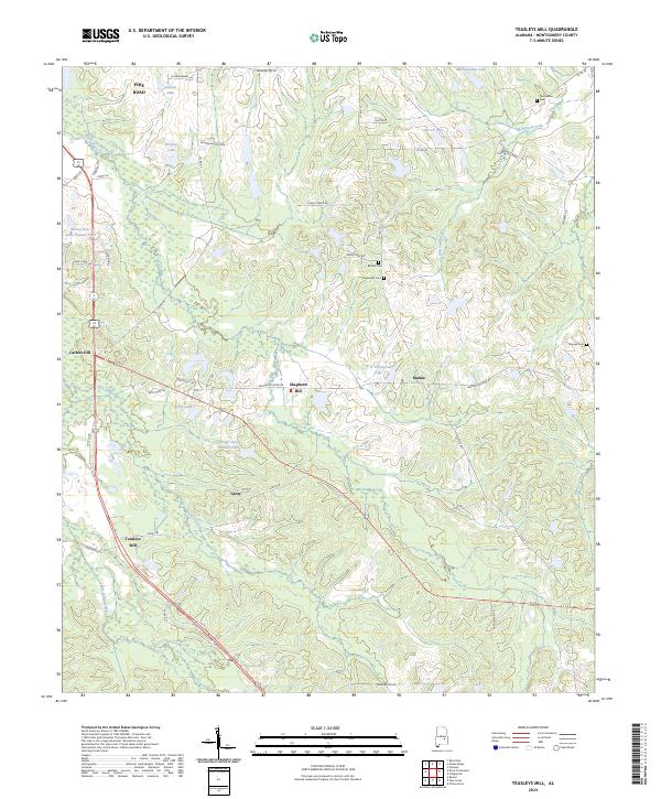
2024 Map of Teasleys Mill
USGS Topo · Published 2024About this map
Teasleys Mill and the surrounding Montgomery County countryside appear here in a landscape defined by small water bodies and historical family landholdings. The terrain is a network of named ponds and creeks, including McDowell Creek and Little Catoma Creek, which supported the early rural economy of the area. Local history is anchored by several small settlements like Mamie and Canty, alongside a series of family and community burial grounds such as Barnett Cem and Meriwether Cem. The transition from rural agriculture to residential growth is visible near Pike Road, where newer roads like Farmington Ln meet established landmarks such as Shepherd Hill. Small lakes, such as Grays Lake and Sorrell Lake, dot the landscape, suggesting a history of private water management for local farming or recreation throughout the 20th century.
Find a feature on this map
55 named features on this map. Tap any name to fly to it.
Don’t see what you’re looking for? This feature index may not catch every label — zoom into the map to look around manually.
Map Details
Editions of this 2024 Teasleys Mill Map
This is the sole edition of this map. No revisions or reprints were ever made.
Other maps of this area

1953 · Montgomery
USGS Topo · 1:250,000

1955 · Phenix City
USGS Topo · 1:250,000

1956 · Montgomery
USGS Topo · 1:250,000

1957 · Phenix City
USGS Topo · 1:250,000

1957 · Montgomery
USGS Topo · 1:250,000

1958 · Phenix City
USGS Topo · 1:250,000

1958 · Mount Meigs
USGS Topo · 1:62,500
1971 · China Grove
USGS Topo · 1:24,000
1971 · Fitzpatrick
USGS Topo · 1:24,000

1971 · Davis Crossroads
USGS Topo · 1:24,000