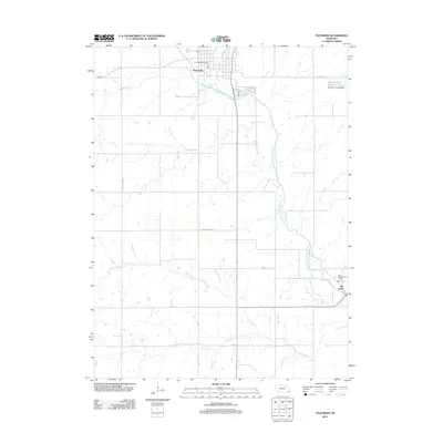
2012 Map of Tecumseh
USGS Topo · Published 2012About this map
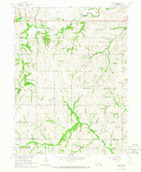
The North Fork Big Nemaha River carves through this portion of Johnson County, anchoring a landscape defined by its tributary system and rural road network. At the northern edge, the city of Tecumseh serves as the primary hub, where Webster St and the Tecumseh Post Office reflect the area's established civic structure. To the southeast, the smaller community of Elk Creek sits near the confluence of the river and its namesake stream, Elk Creek, maintaining its own local identity with the Elk Creek Post Office. The terrain is intricately drained by numerous named waterways including Badger Branch, Logan Branch, and Todd Creek, illustrating the hydraulic complexity of this agricultural region. Evidence of local water management is seen in the Spring Creek Reservoir 9-2 and its associated Spring Creek Dam 9-2 in the northeastern corner, highlighting how the natural river valley has been adapted for regional needs.
Find a feature on this map
15 named features on this map. Tap any name to fly to it.
Don’t see what you’re looking for? This feature index may not catch every label — zoom into the map to look around manually.
Map Details
Editions of this 2012 Tecumseh Map
This is the sole edition of this map. No revisions or reprints were ever made.
Other maps of this area

1955 · Lincoln
USGS Topo · 1:250,000

1957 · Lincoln
USGS Topo · 1:250,000

1958 · Lincoln
USGS Topo · 1:250,000

1965 · Burchard
USGS Topo · 1:24,000

1965 · Table Rock
USGS Topo · 1:24,000

1965 · Tecumseh
USGS Topo · 1:24,000
1965 · Steinauer
USGS Topo · 1:24,000
1965 · Tecumseh SE
USGS Topo · 1:24,000
1965 · Tecumseh NW
USGS Topo · 1:24,000
1965 · Vesta
USGS Topo · 1:24,000