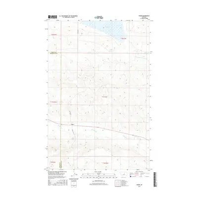
2017 Map of Teigen
USGS Topo · Published 2017About this map
The small settlement of Teigen serves as a focal point in this Central Montana landscape, situated near the boundary where Fergus County and Petroleum County meet. The geography is defined by a series of intermittent watercourses including Buffalo Creek, Dry Creek, and the winding McDonald Creek which traverses the southern portion of the quadrangle. To the north, the presence of War Horse Lake and the Winnett Irrigation County Ditch indicates the essential role of water management in this arid ranching and farming region. The local transportation network consists of rural corridors like Blakeslee Road and the Double S Cutoff, which connect the scattered holdings across the high plains. This 2017 survey illustrates the persistent rural character of the area, where land use is dictated by the drainage patterns of the Missouri River watershed.
Find a feature on this map
15 named features on this map. Tap any name to fly to it.
Don’t see what you’re looking for? This feature index may not catch every label — zoom into the map to look around manually.
Map Details
Editions of this 2017 Teigen Map
This is the sole edition of this map. No revisions or reprints were ever made.
Other maps of this area
1954 · Roundup
USGS Topo · 1:250,000
1954 · Lewistown
USGS Topo · 1:250,000
1958 · Roundup
USGS Topo · 1:250,000
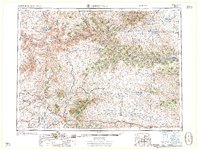
1959 · Lewistown
USGS Topo · 1:250,000
1986 · Snoose Creek
USGS Topo · 1:24,000
1986 · Wild Horse Lake
USGS Topo · 1:24,000
1986 · Briggs Coulee
USGS Topo · 1:24,000
1986 · Dry Blood Creek West
USGS Topo · 1:24,000
1986 · Teigen NW
USGS Topo · 1:24,000
1986 · Milk Springs
USGS Topo · 1:24,000