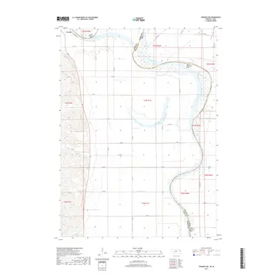
2017 Map of Tekamah NW
USGS Topo · Published 2017About this map
Decatur sits prominently on the western bluffs where the river plain transitions into higher ground, overlooking the complex oxbows and drainage systems of the Missouri River valley. This 2017 survey reveals the intricate hydrography along the Nebraska-Iowa state line, including the substantial Lake Quinnebaugh and the engineered channels of Wuchoff Ditch and Riverside Ditch. The map illustrates the shifting nature of the river's path, preserved in named meanders such as Lower Decatur Bend, Upper Louisville Bend, and Lower Blencoe Bend.
Find a feature on this map
42 named features on this map. Tap any name to fly to it.
Don’t see what you’re looking for? This feature index may not catch every label — zoom into the map to look around manually.
Map Details
Editions of this 2017 Tekamah NW Map
This is the sole edition of this map. No revisions or reprints were ever made.
Other maps of this area

1955 · Sioux City
USGS Topo · 1:250,000

1955 · Fremont
USGS Topo · 1:250,000

1957 · Fremont
USGS Topo · 1:250,000

1958 · Sioux City
USGS Topo · 1:250,000

1958 · Fremont
USGS Topo · 1:250,000

1959 · Sioux City
USGS Topo · 1:250,000

1966 · Macy
USGS Topo · 1:24,000

1969 · Onawa
USGS Topo · 1:24,000
1969 · Onawa SW
USGS Topo · 1:24,000

1970 · Oakland SE
USGS Topo · 1:24,000