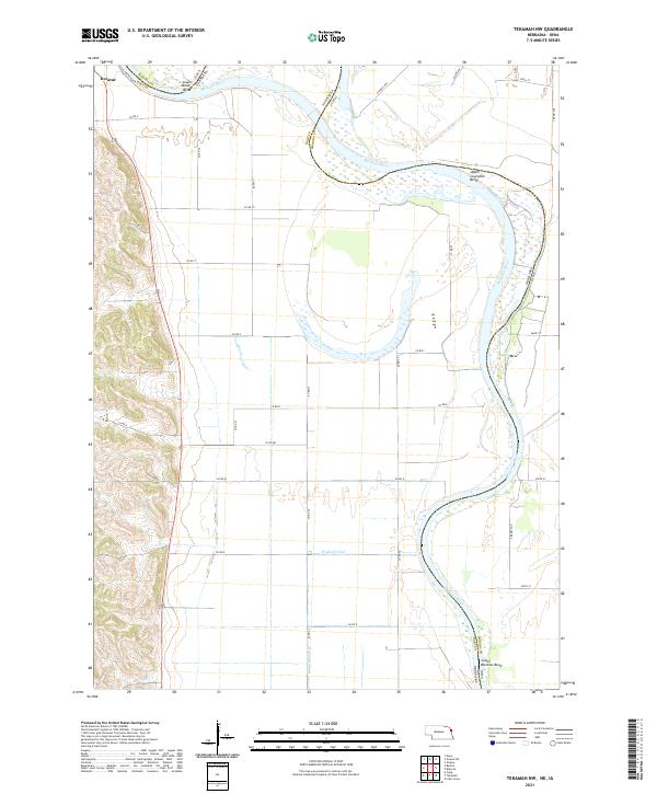
2021 Map of Tekamah NW
USGS Topo · Published 2021About this map
The Missouri River defines the landscape of this Burt County region, carving its way along the border between Nebraska and Iowa. The river's winding path is marked by significant hydrological features such as Lower Decatur Bend, Upper Louisville Bend, and Lower Blencoe Bend. These sweeping curves reflect the dynamic nature of the waterway, which has historically shifted and shaped the surrounding bottomlands. The settlement of Decatur sits in the northwest corner of the map, serving as a key point of reference near the confluence of local routes like S Riverview Dr.
Find a feature on this map
44 named features on this map. Tap any name to fly to it.
Don’t see what you’re looking for? This feature index may not catch every label — zoom into the map to look around manually.
Map Details
Editions of this 2021 Tekamah NW Map
This is the sole edition of this map. No revisions or reprints were ever made.
Other maps of this area

1955 · Sioux City
USGS Topo · 1:250,000

1955 · Fremont
USGS Topo · 1:250,000

1957 · Fremont
USGS Topo · 1:250,000

1958 · Sioux City
USGS Topo · 1:250,000

1958 · Fremont
USGS Topo · 1:250,000

1959 · Sioux City
USGS Topo · 1:250,000

1966 · Macy
USGS Topo · 1:24,000

1969 · Onawa
USGS Topo · 1:24,000
1969 · Onawa SW
USGS Topo · 1:24,000

1970 · Oakland SE
USGS Topo · 1:24,000