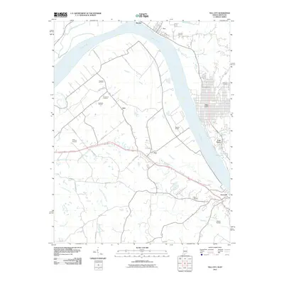
2010 Map of Tell City
USGS Topo · Published 2010About this map
The Ohio River carves a deep bend through this borderland, separating the urban grid of Tell City and its smaller neighbors like Troy and Maxville in Indiana from the Kentucky bank at Hawesville. The landscape is defined by the complex drainage systems feeding the river, including the South Yellow Creek Fork and Lead Creek, which wind through a mosaic of rural roads and established settlements.
Find a feature on this map
46 named features on this map. Tap any name to fly to it.
Don’t see what you’re looking for? This feature index may not catch every label — zoom into the map to look around manually.
Map Details
Editions of this 2010 Tell City Map
This is the sole edition of this map. No revisions or reprints were ever made.
Other maps of this area

1900 · St Meinrad
USGS Topo · 1:62,500

1903 · St. Meinrad
USGS Topo · 1:62,500

1903 · Tell City
USGS Topo · 1:62,500

1934 · Cannelton
USGS Topo · 1:62,500

1949 · Cannelton
USGS Topo · 1:24,000

1953 · Cannelton
USGS Topo · 1:24,000

1953 · Lewisport
USGS Topo · 1:24,000

1953 · Cloverport
USGS Topo · 1:24,000

1953 · Tell City
USGS Topo · 1:24,000
1953 · Maceo
USGS Topo · 1:24,000