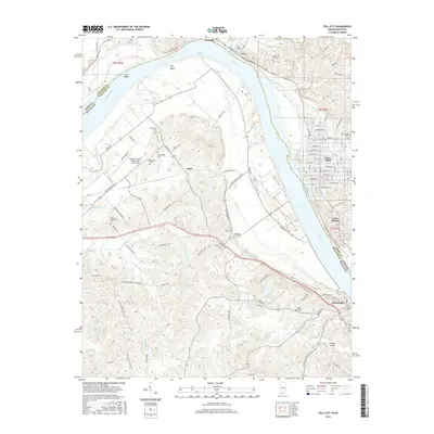
2016 Map of Tell City
USGS Topo · Published 2016About this map
The Ohio River carves a deep bend through this borderland, separating the grid-patterned streets of Tell City, Indiana, from the Kentucky bank where Hawesville and Fenn Haven sit. The landscape is defined by the river’s influence, from the broad Troy Bend and Corn Island to the many winding tributaries like Anderson River and Lead Creek. This river corridor serves as a historical and industrial artery, evidenced by the Southwire Plant Road and proximity to Hancock County Airport-Ron Lewis Field.
Find a feature on this map
99 named features on this map. Tap any name to fly to it.
Don’t see what you’re looking for? This feature index may not catch every label — zoom into the map to look around manually.
Map Details
Editions of this 2016 Tell City Map
This is the sole edition of this map. No revisions or reprints were ever made.
Other maps of this area

1900 · St Meinrad
USGS Topo · 1:62,500

1903 · St. Meinrad
USGS Topo · 1:62,500

1903 · Tell City
USGS Topo · 1:62,500

1934 · Cannelton
USGS Topo · 1:62,500

1949 · Cannelton
USGS Topo · 1:24,000

1953 · Cannelton
USGS Topo · 1:24,000

1953 · Lewisport
USGS Topo · 1:24,000

1953 · Cloverport
USGS Topo · 1:24,000

1953 · Tell City
USGS Topo · 1:24,000
1953 · Maceo
USGS Topo · 1:24,000