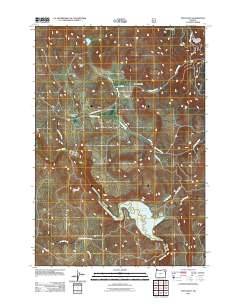
2011 Map of Telocaset
USGS Topo · Published 2011About this map
Telocaset sits as a primary junction where the landscape of Union County transitions between the high summits and the fertile valleys of eastern Oregon. This 2011 survey illustrates a region defined by its water management and agricultural geography, centered on the Thief Valley Reservoir and the Powder River drainage. The map provides a detailed view of the local topography, from the heights of Clark Mountain and Telocaset Hill down to the basins of Antelope Valley and Thief Valley. Named landforms like Government Gulch and Prescott Gulch suggest a history of public land administration and local ranching. Smaller settlements such as Sago and established routes like Telocaset Rd and Thief Valley Rd anchor the human presence within this complex drainage system of Spring Creek, Antelope Creek, and Cusick Creek.
Find a feature on this map
23 named features on this map. Tap any name to fly to it.
Don’t see what you’re looking for? This feature index may not catch every label — zoom into the map to look around manually.
Map Details
Editions of this 2011 Telocaset Map
This is the sole edition of this map. No revisions or reprints were ever made.
Other maps of this area

1901 · Baker City
USGS Topo · 1:125,000

1906 · Telocaset
USGS Topo · 1:125,000

1955 · Baker
USGS Topo · 1:250,000

1955 · Grangeville
USGS Topo · 1:250,000

1959 · Baker
USGS Topo · 1:250,000

1959 · Grangeville
USGS Topo · 1:250,000

1965 · Union
USGS Topo · 1:24,000

1965 · Medical Springs
USGS Topo · 1:24,000
1965 · North Powder
USGS Topo · 1:24,000

1965 · Little Catherine Creek
USGS Topo · 1:24,000