
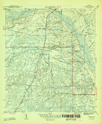
1946 Map of Telogia
USGS Topo · Published 1946About this map
Telogia stands as a central settlement in the Florida panhandle just after World War II, situated along the Apalachicola Northern railroad line. This 1946 survey details the extensive wetlands and tributary networks within the Apalachicola National Forest, including Telogia Creek, Yellow Creek, and the swampy expanse of Big Cypress. The map records several small family and local burial grounds, such as Old Burnoff Cem, Evans Cem, and Mcnair Cem, which offer significant value for genealogical research in Liberty County. Natural terrain features like the Brushy Islands and the Black Cat Islands characterize the low-lying landscape, while landmarks like Conners Ford and the Mercer Firetower indicate how residents and foresters navigated this water-dominated environment.
Find a feature on this map
32 named features on this map. Tap any name to fly to it.
Don’t see what you’re looking for? This feature index may not catch every label — zoom into the map to look around manually.
Map Details
Editions of this 1946 Telogia Map
2 editions found
Other maps of this area

1943 · Lake Talquin
USGS Topo · 1:62,500

1944 · Queens Bay
USGS Topo · 1:24,000

1945 · Smith Creek
USGS Topo · 1:31,680

1945 · Hosford
USGS Topo · 1:31,680

1945 · Bristol
USGS Topo · 1:31,680

1945 · Woods
USGS Topo · 1:31,680

1945 · Telogia
USGS Topo · 1:24,000

1946 · Queens Bay
USGS Topo · 1:31,680
1946 · Wilma
USGS Topo · 1:31,680

1954 · Tallahassee
USGS Topo · 1:250,000