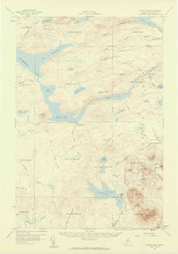
1957 Map of Telos Lake
USGS Topo · Published 1960About this map
Chamberlain Lake and the interconnected waters of the North Maine Woods define this remote landscape at the threshold of the late 1950s. The map illustrates a region dominated by timber-and-water geography, where the Lake Tote Road and Telos Tote Road provide the primary terrestrial access to the interior. Notable elevations such as Burnt Mtn Lookout Tower and Strickland Mtn overlook a complex network of bogs and smaller ponds, including Black Spruce Bog and Little Coffeelos Pond. The southeastern corner transitions into Baxter State Park, marked by its boundary lines near Camp Phoenix on the shores of Nesowadnehunk Lake. This survey preserves the exact footprint of the logging industry's infrastructure before modern forest management changed the character of these northern townships.
Find a feature on this map
67 named features on this map. Tap any name to fly to it.
Don’t see what you’re looking for? This feature index may not catch every label — zoom into the map to look around manually.
Map Details
Editions of this 1957 Telos Lake Map
4 editions found

Other maps of this area

1927 · Katahdin
USGS Topo · 1:48,000

1930 · Katahdin
USGS Topo · 1:62,500

1949 · Katahdin
USGS Topo · 1:62,500

1953 · Telos Lake
USGS Topo · 1:62,500

1954 · Chesuncook
USGS Topo · 1:62,500

1954 · Spider Lake
USGS Topo · 1:62,500

1954 · Churchill Lake
USGS Topo · 1:62,500

1954 · Grant Farm
USGS Topo · 1:62,500

1954 · Harrington Lake
USGS Topo · 1:62,500

1954 · Millinocket Lake
USGS Topo · 1:62,500