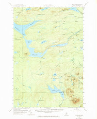
1957 Map of Telos Lake
USGS Topo · Published 1969About this map
The remote West East Letter Series (WELS) townships of Piscataquis County are defined by a complex network of glacial lakes and logging infrastructure as they appeared in the late 1950s. At the heart of the sheet lies Telos Lake and the Telos Dam, a critical site for managing water flow between the Chamberlain Lake system and the E Branch Penobscot R. The landscape transitions from the aquatic expanse of the Arm of Chamberlain Lake to the mountainous terrain of the east, where the Baxter State Park Boundary encloses high points like Center Mtn and Burnt Mtn. Settlement is nearly non-existent, represented primarily by Camp Phoenix and a series of primitive transport routes such as the Old Tote Road and various jeep trails. This survey documents the area's transition into a managed wilderness, balancing historic timber-driving routes with early conservation efforts near the park's edge.
Find a feature on this map
76 named features on this map. Tap any name to fly to it.
Don’t see what you’re looking for? This feature index may not catch every label — zoom into the map to look around manually.
Map Details
Editions of this 1957 Telos Lake Map
4 editions found

Other maps of this area

1927 · Katahdin
USGS Topo · 1:48,000

1930 · Katahdin
USGS Topo · 1:62,500

1949 · Katahdin
USGS Topo · 1:62,500

1953 · Telos Lake
USGS Topo · 1:62,500

1954 · Chesuncook
USGS Topo · 1:62,500

1954 · Spider Lake
USGS Topo · 1:62,500

1954 · Churchill Lake
USGS Topo · 1:62,500

1954 · Grant Farm
USGS Topo · 1:62,500

1954 · Harrington Lake
USGS Topo · 1:62,500

1954 · Millinocket Lake
USGS Topo · 1:62,500