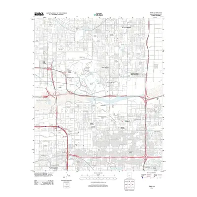
2011 Map of Tempe
USGS Topo · Published 2011About this map
Arizona State University Tempe Campus serves as a central anchor for this urbanized desert landscape, where the Salt River channel divides the expanding residential reaches of Tempe and Scottsdale. The map captures a sophisticated network of water management and recreation, from the historic Arizona Canal and Arizona Falls Power House to a high density of golf courses like Karsten Golf Course and Papago Golf Course. Geological landmarks such as the Papago Buttes and Hole in the Rock remain preserved amidst the sprawl of neighborhood subdivisions like McClintock Manor and Minnesota Court. For local historians, the sheet is particularly dense with burial sites, including the Saint Francis Cemetery and the Maricopa County Cemetery, alongside unique cultural markers like the Water Users Yaqui Camp.
Find a feature on this map
60 named features on this map. Tap any name to fly to it.
Don’t see what you’re looking for? This feature index may not catch every label — zoom into the map to look around manually.
Map Details
Editions of this 2011 Tempe Map
This is the sole edition of this map. No revisions or reprints were ever made.
Other maps of this area

1904 · Camelback
USGS Topo · 1:62,500

1906 · Camelsback
USGS Topo · 1:62,500

1912 · Phoenix
USGS Topo · 1:62,500

1913 · Mesa
USGS Topo · 1:62,500

1914 · Phoenix
USGS Topo · 1:62,500

1915 · Mesa
USGS Topo · 1:62,500

1930 · Cave Creek
USGS Topo · 1:125,000

1939 · Cave Creek
USGS Topo · 1:125,000

1952 · Tempe
USGS Topo · 1:24,000

1952 · Chandler
USGS Topo · 1:24,000