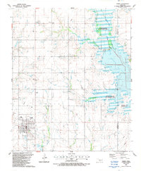
1987 Map of Temple
USGS Topo · Published 1988About this map
Temple stands as the primary hub of this southern Oklahoma landscape, centered in a grid of section-line roads and agricultural fields. This 1980s revision reveals the significant footprint of Waurika Lake to the east, bounded by a series of engineered Levee structures. The map documents the rural infrastructure of the era, from the Temple Airport to the Substation at Fivemile Corner. Local history is preserved in the location of the Temple Cem and Valley View Ch, while the northern reaches show the smaller settlement of Mills. The convergence of Beaver Creek and Little Beaver Creek feeds into a protected State Wildlife Management Area, illustrating the transition from traditional prairie creek beds to a modern reservoir system that reshaped the topography near the Cotton and Stephens County line.
Find a feature on this map
21 named features on this map. Tap any name to fly to it.
Don’t see what you’re looking for? This feature index may not catch every label — zoom into the map to look around manually.
Map Details
Editions of this 1987 Temple Map
This is the sole edition of this map. No revisions or reprints were ever made.
Other maps of this area

1955 · Lawton
USGS Topo · 1:250,000

1957 · Hastings
USGS Topo · 1:62,500

1957 · Randlett
USGS Topo · 1:62,500

1962 · Walters
USGS Topo · 1:62,500

1962 · Temple
USGS Topo · 1:62,500

1984 · Hooper
USGS Topo · 1:24,000
1984 · Waurika West
USGS Topo · 1:24,000
1985 · Taylor
USGS Topo · 1:24,000

1985 · Burkburnett
USGS Topo · 1:100,000
1987 · Walters NE
USGS Topo · 1:24,000