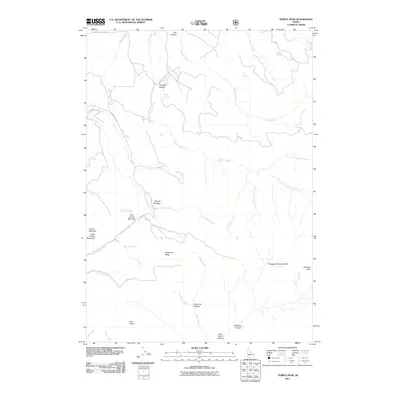
2011 Map of Temple Peak
USGS Topo · Published 2011About this map
Moody Meadow and the surrounding high country of Madison County are defined by a complex network of drainage basins and ridges in this 2011 survey. The landscape is carved by prominent watercourses like Calamity Creek, Canyon Creek, and Ruby Creek, which flow through deeply recessed terrain such as Coalmine Canyon and Beartrap Canyon. Evidence of the area's geological and hydrological character is found in the many named water sources, including Bex Spring and Graham Spring.
Find a feature on this map
42 named features on this map. Tap any name to fly to it.
Don’t see what you’re looking for? This feature index may not catch every label — zoom into the map to look around manually.
Map Details
Editions of this 2011 Temple Peak Map
This is the sole edition of this map. No revisions or reprints were ever made.
Other maps of this area

1943 · Garns Mtn
USGS Topo · 1:62,500

1946 · Garns Mtn
USGS Topo · 1:62,500

1951 · Hawley Gulch
USGS Topo · 1:24,000

1951 · Heise SE
USGS Topo · 1:24,000

1951 · White Owl Butte
USGS Topo · 1:24,000

1955 · Driggs
USGS Topo · 1:250,000

1958 · Driggs
USGS Topo · 1:250,000

1962 · Driggs
USGS Topo · 1:250,000

1965 · Packsaddle Lake
USGS Topo · 1:24,000
1965 · Wright Creek
USGS Topo · 1:24,000