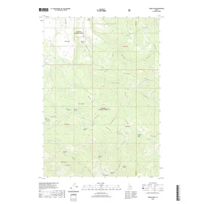
2020 Map of Temple Peak
USGS Topo · Published 2020About this map
Targhee National Forest dominates this mountain landscape along the border of Madison and Teton Counties. The terrain is defined by a series of steep drainages including Calamity Creek, Hilton Creek, and Big Burns Creek that flow through canyons such as Hell Hole Canyon and Beartrap Canyon. A notable human imprint on this wilderness is the Coalmine located near Coalmine Canyon, suggesting the area's history of mineral exploration.
Find a feature on this map
69 named features on this map. Tap any name to fly to it.
Don’t see what you’re looking for? This feature index may not catch every label — zoom into the map to look around manually.
Map Details
Editions of this 2020 Temple Peak Map
This is the sole edition of this map. No revisions or reprints were ever made.
Other maps of this area

1943 · Garns Mtn
USGS Topo · 1:62,500

1946 · Garns Mtn
USGS Topo · 1:62,500

1951 · Hawley Gulch
USGS Topo · 1:24,000

1951 · Heise SE
USGS Topo · 1:24,000

1951 · White Owl Butte
USGS Topo · 1:24,000

1955 · Driggs
USGS Topo · 1:250,000

1958 · Driggs
USGS Topo · 1:250,000

1962 · Driggs
USGS Topo · 1:250,000

1965 · Packsaddle Lake
USGS Topo · 1:24,000
1965 · Wright Creek
USGS Topo · 1:24,000