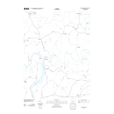
2013 Map of Templeton
USGS Topo · Published 2013About this map
The Allegheny River flows prominently through this 2013 Armstrong County landscape, carving a deep valley that defines the local geography. Along its eastern bank, the settlement of Templeton serves as a focal point, situated near the mouth of Wiskey Cr. To the north, the river winds past Grays Eddy and Reesedale, while the interior terrain is marked by high points like Fire Hill and several small rural communities including Widnoon, Kellersburg, and Deanville.
Find a feature on this map
87 named features on this map. Tap any name to fly to it.
Don’t see what you’re looking for? This feature index may not catch every label — zoom into the map to look around manually.
Map Details
Editions of this 2013 Templeton Map
This is the sole edition of this map. No revisions or reprints were ever made.
Other maps of this area

1900 · Kittanning
USGS Topo · 1:62,500

1901 · Rural Valley
USGS Topo · 1:62,500

1902 · Kittanning
USGS Topo · 1:62,500
1903 · Rural Valley
USGS Topo · 1:62,500
1906 · Clarion
USGS Topo · 1:62,500
1907 · Clarion
USGS Topo · 1:62,500

1907 · Foxburg
USGS Topo · 1:62,500

1908 · Foxburg
USGS Topo · 1:62,500

1953 · Pittsburgh
USGS Topo · 1:250,000
1954 · Pittsburgh
USGS Topo · 1:250,000