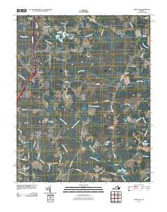
2010 Map of Templeton
USGS Topo · Published 2010About this map
Lees Mill and the surrounding Prince George County wetlands dominate this 2010 landscape, where industrial remnants and family-named water bodies define the local geography. The area around Templeton serves as a modern crossroads, yet the map preserves traces of an older agrarian and industrial past. Numerous millponds and dams, such as Belsches Millpond and Johnsons Pond, are interconnected by a dense network of drainage systems including Warwick Swamp, Joseph Swamp, and Jones Hole Swamp.
Find a feature on this map
48 named features on this map. Tap any name to fly to it.
Don’t see what you’re looking for? This feature index may not catch every label — zoom into the map to look around manually.
Map Details
Editions of this 2010 Templeton Map
This is the sole edition of this map. No revisions or reprints were ever made.
Other maps of this area

1894 · Petersburg
USGS Topo · 1:62,500

1919 · Jarratt
USGS Topo · 1:62,500

1919 · Disputanta
USGS Topo · 1:62,500

1919 · Homeville
USGS Topo · 1:48,000

1920 · Homeville
USGS Topo · 1:62,500

1943 · Littleton
USGS Topo · 1:31,680

1943 · Disputanta
USGS Topo · 1:31,680

1943 · Richmond
USGS Topo · 1:250,000

1944 · Reams
USGS Topo · 1:31,680
1944 · Petersburg
USGS Topo · 1:31,680