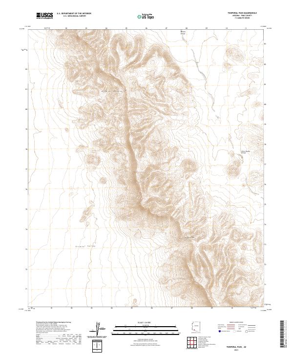
2021 Map of Temporal Pass
USGS Topo · Published 2021About this map
Growler Mountains dominate the landscape in this Pima County survey, providing a sharp topographical barrier between the high peaks and the broad expanse of Growler Valley to the west. This 2021 edition documents the drainage patterns of the desert floor, where Daniels Arroyo and Chico Shunie Arroyo carve through the arid terrain. The map centers on the namesake Temporal Pass, a natural corridor through the steep ridges. The absence of modern development highlights the preserved state of this corner of the Sonoran Desert, emphasizing the ancient geological features and the dry wash systems that define the area's hydrology. It serves as a detailed record of public land divisions, specifically noting the intersection of several townships including t13s r8w and t12s r7w.
Find a feature on this map
9 named features on this map. Tap any name to fly to it.
Don’t see what you’re looking for? This feature index may not catch every label — zoom into the map to look around manually.
Map Details
Editions of this 2021 Temporal Pass Map
This is the sole edition of this map. No revisions or reprints were ever made.
Other maps of this area

1932 · Ajo
USGS Topo · 1:62,500

1934 · Ajo
USGS Topo · 1:62,500

1953 · Ajo
USGS Topo · 1:250,000

1957 · Ajo
USGS Topo · 1:250,000

1958 · Ajo
USGS Topo · 1:250,000

1962 · Ajo
USGS Topo · 1:250,000

1963 · Ajo
USGS Topo · 1:250,000

1963 · Ajo
USGS Topo · 1:62,500

1963 · Kino Peak
USGS Topo · 1:62,500

1964 · Growler Peak
USGS Topo · 1:62,500