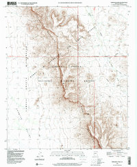
1996 Map of Temporal Pass
USGS Topo · Published 2000About this map
The Growler Mountains dominate this high-desert landscape in Pima County, serving as a natural divider between the arid expanse of Growler Valley and the rugged terrain to the east. This 1996 update reflects a region defined by federal stewardship and military utility, as the boundary for the Barry M. Goldwater Air Force Range intersects with the Cabeza Prieta National Wildlife Refuge. The map provides specific topographic detail for Temporal Pass, a critical gap in the mountain range that historically facilitated movement through this demanding environment.
Find a feature on this map
14 named features on this map. Tap any name to fly to it.
Don’t see what you’re looking for? This feature index may not catch every label — zoom into the map to look around manually.
Map Details
Editions of this 1996 Temporal Pass Map
This is the sole edition of this map. No revisions or reprints were ever made.
Other maps of this area

1932 · Ajo
USGS Topo · 1:62,500

1934 · Ajo
USGS Topo · 1:62,500

1953 · Ajo
USGS Topo · 1:250,000

1957 · Ajo
USGS Topo · 1:250,000

1958 · Ajo
USGS Topo · 1:250,000

1962 · Ajo
USGS Topo · 1:250,000

1963 · Ajo
USGS Topo · 1:250,000

1963 · Ajo
USGS Topo · 1:62,500

1963 · Kino Peak
USGS Topo · 1:62,500

1964 · Growler Peak
USGS Topo · 1:62,500