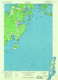
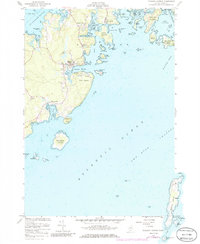
1955 Map of Tenants Harbor
USGS Topo · Published 1969About this map
Tenants Harbor serves as the focal point for this mid-century coastal survey, situated between the St George River and the open Atlantic Ocean. The map documents a maritime landscape defined by a dense archipelago of islands, including Whitehead Island, where a Coast Guard Sta and Lighthouse guided vessels through the Two Bush Channel. The shoreline is heavily indented with coves like Long Cove and Mosquito Harbor, while the inland area shows the small clusters of Martinsville and Elmore. Genealogists will find the locations of Seaside Cem and Hillside Cem preserved in their mid-century context. The southern reaches of the map are dominated by the elongated Metinic Island, while industrial activity is noted near the coast at a Borrow Pit on Hart Neck.
Find a feature on this map
59 named features on this map. Tap any name to fly to it.
Don’t see what you’re looking for? This feature index may not catch every label — zoom into the map to look around manually.
Map Details
Editions of this 1955 Tenants Harbor Map
5 editions found
Other maps of this area

1904 · Monhegan
USGS Topo · 1:62,500

1904 · Tenants Harbor
USGS Topo · 1:62,500

1904 · Rockland
USGS Topo · 1:62,500

1906 · Tennant Harbor
USGS Topo · 1:62,500

1906 · Monhegan
USGS Topo · 1:62,500

1906 · Rockland
USGS Topo · 1:62,500

1913 · Waldoboro
USGS Topo · 1:48,000

1915 · Waldoboro
USGS Topo · 1:62,500

1941 · Rockland
USGS Topo · 1:62,500

1941 · Waldoboro
USGS Topo · 1:62,500