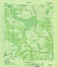
1945 Map of Tenmile Swamp
USGS Topo · Published 1945About this map
Wetappo Forest and the expansive Ten Mile Swamp dominate this mid-century landscape on the border of Calhoun and Gulf counties. The area is defined by a dense network of hydrologic features, including Wetappo Creek and its various tributaries such as Stone Mill Creek and Sandy Branch. This environment is characterized by large, named wetlands like Green Bay Swamp and Petticamp Swamp, which dictated the early movement and settlement patterns of the Florida Panhandle.
Find a feature on this map
24 named features on this map. Tap any name to fly to it.
Don’t see what you’re looking for? This feature index may not catch every label — zoom into the map to look around manually.
Map Details
Editions of this 1945 Tenmile Swamp Map
4 editions found
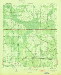
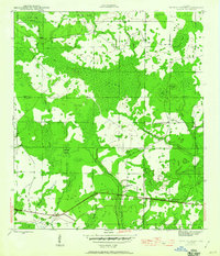
Other maps of this area

1945 · Dead Lake
USGS Topo · 1:31,680

1945 · Youngstown
USGS Topo · 1:31,680

1945 · Broad Branch
USGS Topo · 1:31,680

1945 · Allanton
USGS Topo · 1:31,680

1945 · North Of Allanton
USGS Topo · 1:31,680

1945 · Frink
USGS Topo · 1:31,680

1945 · Wewahitchka
USGS Topo · 1:31,680

1945 · Wetappo Creek
USGS Topo · 1:31,680

1945 · Tenmile Swamp
USGS Topo · 1:31,680

1947 · Allanton
USGS Topo · 1:25,000