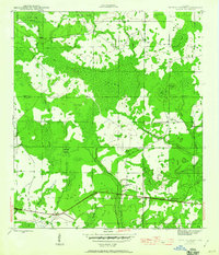
1945 Map of Tenmile Swamp
USGS Topo · Published 1960About this map
Wetappo Swamp and a dense network of watercourses dominate this Florida Panhandle landscape near the boundary of Calhoun Co and Gulf Co. Surveyed during the final year of World War II, the area is characterized by vast wetlands such as Green Bay Swamp and Petticamp Swamp, which would have defined local land use and transit during this era. The concentration of water bodies like Stone Mill Creek and Wetappo Creek suggests a landscape largely shaped by its hydrology, with minimal upland areas such as Two Pen Ridge providing stable ground for human activity.
Find a feature on this map
20 named features on this map. Tap any name to fly to it.
Don’t see what you’re looking for? This feature index may not catch every label — zoom into the map to look around manually.
Map Details
Editions of this 1945 Tenmile Swamp Map
4 editions found
Other maps of this area

1945 · Dead Lake
USGS Topo · 1:31,680

1945 · Youngstown
USGS Topo · 1:31,680

1945 · Broad Branch
USGS Topo · 1:31,680

1945 · Allanton
USGS Topo · 1:31,680

1945 · North Of Allanton
USGS Topo · 1:31,680

1945 · Frink
USGS Topo · 1:31,680

1945 · Wewahitchka
USGS Topo · 1:31,680

1945 · Wetappo Creek
USGS Topo · 1:31,680

1945 · Tenmile Swamp
USGS Topo · 1:31,680

1947 · Allanton
USGS Topo · 1:25,000