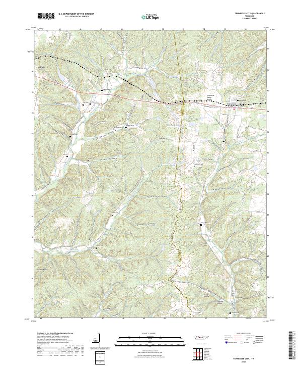
2022 Map of Tennessee City
USGS Topo · Published 2022About this map
The Tennessee Valley Divide cuts through this landscape on the border of Humphreys and Dickson counties, separating the complex drainage networks of the western Highland Rim. The community of Tennessee City sits along the primary east-west road corridor, surrounded by numerous family burial grounds including Rice Cem and the Tennessee City Cem. To the west, the map shows the edge of McEwen, where the terrain begins to drop into a dense system of hollows.
Find a feature on this map
121 named features on this map. Tap any name to fly to it.
Don’t see what you’re looking for? This feature index may not catch every label — zoom into the map to look around manually.
Map Details
Editions of this 2022 Tennessee City Map
This is the sole edition of this map. No revisions or reprints were ever made.
Other maps of this area

1901 · Colombia
USGS Topo · 1:125,000

1936 · Gorman
USGS Topo · 1:24,000

1936 · Woolworth
USGS Topo · 1:24,000

1936 · Ruskin
USGS Topo · 1:24,000

1936 · Bucksnort
USGS Topo · 1:24,000

1936 · Texas Hollow
USGS Topo · 1:24,000

1936 · Spot
USGS Topo · 1:24,000

1936 · Tennessee City
USGS Topo · 1:24,000

1936 · Dickson
USGS Topo · 1:24,000
1952 · Bucksnort
USGS Topo · 1:24,000