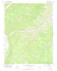
1971 Map of Tercio
USGS Topo · Published 1974About this map
The Maxwell Grant, specifically the Beaubien and Miranda portion, dominates this 1970s landscape in southern Colorado. The settlement of Tercio is centered near the coal mining operations that defined the local economy, including the Tercio Mine and the Vega Mine. These industrial sites are linked by an Old Railroad Grade that follows the winding path of the South Fork Purgatoire River, illustrating the historical dependence on rail for moving resources out of the canyon floor.
Find a feature on this map
26 named features on this map. Tap any name to fly to it.
Don’t see what you’re looking for? This feature index may not catch every label — zoom into the map to look around manually.
Map Details
Editions of this 1971 Tercio Map
3 editions found
Other maps of this area

1891 · Spanish Peaks
USGS Topo · 1:125,000

1893 · Spanish Peaks
USGS Topo · 1:125,000

1895 · Spanish Peaks
USGS Topo · 1:125,000

1897 · Spanish Peaks
USGS Topo · 1:125,000

1900 · Spanish Peaks
USGS Topo · 1:125,000

1954 · Raton
USGS Topo · 1:250,000

1954 · Trinidad
USGS Topo · 1:250,000

1955 · Trinidad
USGS Topo · 1:250,000

1958 · Raton
USGS Topo · 1:250,000

1958 · Trinidad
USGS Topo · 1:250,000