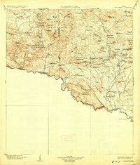
1904 Map of Terlingua
USGS Topo · Published 1926About this map
The remote Chihuahuan Desert landscape of the Big Bend region is defined by the massive circular geological formation known as The Solitario and the deep incision of the Rio Grande. This 1904 edition document records the early ranching and mining period before the establishment of the national park, where isolated outposts like Howard's Ranch and Gourley's Ranch relied on scarce water sources such as Black Tinaja and Joe Black Spring. A lone Telephone Line and various wagon trails connect these scattered habitations to Terlingua and the riverside settlement of Lajitas.
Find a feature on this map
102 named features on this map. Tap any name to fly to it.
Don’t see what you’re looking for? This feature index may not catch every label — zoom into the map to look around manually.
Map Details
Editions of this 1904 Terlingua Map
5 editions found
Other maps of this area

1896 · Polvo
USGS Topo · 1:125,000

1896 · Shafter
USGS Topo · 1:125,000

1903 · Chisos Mountains
USGS Topo · 1:125,000

1903 · Terlingua
USGS Topo · 1:125,000

1904 · Terlingua
USGS Topo · 1:125,000

1905 · Chisos Mountains
USGS Topo · 1:125,000

1917 · Agua Fria
USGS Topo · 1:62,500

1917 · Tascotal Mesa
USGS Topo · 1:62,500

1918 · Bone Spring
USGS Topo · 1:125,000

1918 · Nine Point Mesa
USGS Topo · 1:62,500