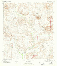
1971 Map of Terlingua
USGS Topo · Published 1974About this map
Terlingua and Study Butte serve as the primary human anchors in this arid landscape, where the Chihuahuan Desert meets the northern reaches of Big Bend National Park. The 1971 field survey documents a region defined by its mercurial mining history and geological transition. Numerous unnamed ruins and mines are scattered across the slopes of Cigar Spring Mountain and the Reed Plateau, testifying to the area's intensive quicksilver production era. The presence of a Cem near the primary settlements and the Terlingua Landing Strip suggests a community in transition between its industrial past and its emerging role as a remote gateway. The complex drainage patterns of Terlingua Creek, fed by seasonal flows like Rough Run and Dawson Creek, carve through the striking limestone formation of Cuesta Blanca.
Find a feature on this map
35 named features on this map. Tap any name to fly to it.
Don’t see what you’re looking for? This feature index may not catch every label — zoom into the map to look around manually.
Map Details
Editions of this 1971 Terlingua Map
3 editions found
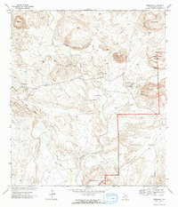
Other maps of this area

1903 · Chisos Mountains
USGS Topo · 1:125,000

1903 · Terlingua
USGS Topo · 1:125,000

1904 · Terlingua
USGS Topo · 1:125,000

1905 · Chisos Mountains
USGS Topo · 1:125,000

1959 · Emory Peak
USGS Topo · 1:250,000

1965 · Emory Peak
USGS Topo · 1:250,000

1971 · Yellow Hill
USGS Topo · 1:24,000

1971 · Terlingua
USGS Topo · 1:24,000

1971 · Cerro Castellan
USGS Topo · 1:24,000

1971 · Amarilla Mountain
USGS Topo · 1:24,000