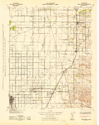
1942 Map of Terra Bella
USGS Topo · Published 1942About this map
Agricultural development and early irrigation networks define the landscape of the San Joaquin Valley in this wartime survey. Large family operations and commercial holdings like Deer Creek Ranch and Hunsaker Ranch are scattered across the plains, while the rural education system is anchored by the Saucelito Sch and Thermal Sch. The regional economy is clearly oriented toward the rail lines, with the Southern Pacific and Atchison Topeka and Santa Fe providing the primary transportation corridors for produce moving from settlements like Terra Bella and Ducor.
Find a feature on this map
45 named features on this map. Tap any name to fly to it.
Don’t see what you’re looking for? This feature index may not catch every label — zoom into the map to look around manually.
Map Details
Editions of this 1942 Terra Bella Map
This is the sole edition of this map. No revisions or reprints were ever made.
Other maps of this area

1904 · Kaweah
USGS Topo · 1:125,000

1909 · Kaweah
USGS Topo · 1:125,000

1925 · Tipton
USGS Topo · 1:31,680

1926 · Quincy School
USGS Topo · 1:31,680

1927 · McFarland
USGS Topo · 1:31,680

1928 · Tipton
USGS Topo · 1:31,680

1928 · Woodville
USGS Topo · 1:31,680

1929 · Delano
USGS Topo · 1:31,680

1929 · Sausalito School
USGS Topo · 1:31,680

1929 · Richgrove
USGS Topo · 1:31,680