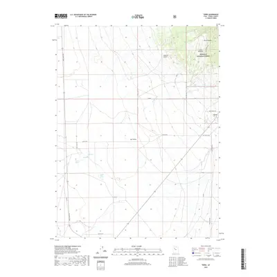
2020 Map of Terra
USGS Topo · Published 2020About this map
Skull Valley defines the arid landscape of this 2020 survey, where the small settlement of Terra sits at the edge of the Wasatch National Forest. The map documents a critical corridor of western transportation history, showing both the modern Lincoln Hwy and segments of the Old Lincoln Hwy as they traverse the desert floor. Water is the primary driver of life here, marked by a series of vital desert watering points including Cold Spring, Big Spring, Scribner Spring, and Jenning Springs. To the northeast, the terrain rises into the national forest, featuring named landmarks like Condie Meadows, Barlow Hollow, and Deadman Canyon. This modern digital survey provides a precise record of how historic transit routes and natural springs continue to shape the geography of Tooele County.
Find a feature on this map
23 named features on this map. Tap any name to fly to it.
Don’t see what you’re looking for? This feature index may not catch every label — zoom into the map to look around manually.
Map Details
Editions of this 2020 Terra Map
This is the sole edition of this map. No revisions or reprints were ever made.
Other maps of this area

1885 · Tooele Valley
USGS Topo · 1:250,000

1953 · Tooele
USGS Topo · 1:250,000

1955 · Tabbys Peak SE
USGS Topo · 1:24,000

1955 · Camels Back Ridge NE
USGS Topo · 1:24,000

1955 · Davis Knolls
USGS Topo · 1:24,000

1955 · Deseret Peak
USGS Topo · 1:62,500

1955 · Tooele
USGS Topo · 1:250,000

1971 · Onaqui Mts South
USGS Topo · 1:24,000

1973 · Hickman Knolls
USGS Topo · 1:24,000

1979 · Rush Valley
USGS Topo · 1:100,000