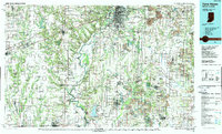
1986 Map of Terre Haute
USGS Topo · Published 1989About this map
The Wabash River serves as the central artery for this mid-1980s landscape, winding through a border region defined by coal extraction and heavy rail transport. Industrial activity is prominent, specifically visible in the extensive Strip Mine operations scattered throughout the eastern half of the map near Linton and Jasonville. The region is a dense network of major transit corridors, including the Seaboard System RR and Illinois Central Gulf RR, which support the movement of resources from the mines to urban hubs like Terre Haute.
Find a feature on this map
208 named features on this map. Tap any name to fly to it.
Don’t see what you’re looking for? This feature index may not catch every label — zoom into the map to look around manually.
Map Details
Editions of this 1986 Terre Haute Map
2 editions found
Other maps of this area

1908 · Clay City
USGS Topo · 1:48,000

1908 · Bloomfield
USGS Topo · 1:62,500

1910 · Clay City
USGS Topo · 1:62,500

1910 · Hardinville
USGS Topo · 1:62,500

1917 · Birds
USGS Topo · 1:62,500

1932 · Marshall
USGS Topo · 1:62,500

1933 · Toledo
USGS Topo · 1:62,500

1936 · Oakland
USGS Topo · 1:48,000

1936 · Casey
USGS Topo · 1:48,000

1937 · Marshall
USGS Topo · 1:62,500