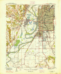
1948 Map of Terre Haute
USGS Topo · Published 1948About this map
The Wabash River carves a sweeping path through this mid-century landscape, separating the dense urban grid of Terre Haute from the smaller settlements of West Terre Haute and Taylorsville. On the eastern bank, a sophisticated network of rail lines including the Pennsylvania and New York Central converge near Union Sta, supporting a city defined by its numerous educational institutions such as Garfield High Sch and Booker Washington Sch.
Find a feature on this map
83 named features on this map. Tap any name to fly to it.
Don’t see what you’re looking for? This feature index may not catch every label — zoom into the map to look around manually.
Map Details
Editions of this 1948 Terre Haute Map
2 editions found
Other maps of this area

1932 · Marshall
USGS Topo · 1:62,500

1937 · Marshall
USGS Topo · 1:62,500

1940 · Lewis
USGS Topo · 1:24,000

1940 · Pimento
USGS Topo · 1:24,000

1941 · Seelyville
USGS Topo · 1:24,000

1941 · Terre Haute
USGS Topo · 1:24,000

1942 · Hutton
USGS Topo · 1:24,000

1942 · Dennison
USGS Topo · 1:24,000

1947 · Paris
USGS Topo · 1:62,500

1948 · Terre Haute
USGS Topo · 1:24,000