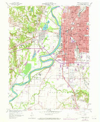
1958 Map of Terre Haute
USGS Topo · Published 1973About this map
The Wabash River carves a wide path through this mid-century survey, separating the dense grid of Terre Haute from western neighborhoods like West Terre Haute and the uniquely named Toad Hop. Industrial and civic life is prominent, with the Federal Penitentiary and Prison south of the city and the massive Dresser Power Plant on the riverbank. The landscape reflects a transition from urban infrastructure to river bottomlands, where the trace of the historic Wabash and Erie Canal is still visible near the County Fairgrounds.
Find a feature on this map
100 named features on this map. Tap any name to fly to it.
Don’t see what you’re looking for? This feature index may not catch every label — zoom into the map to look around manually.
Map Details
Editions of this 1958 Terre Haute Map
3 editions found
Other maps of this area

1932 · Marshall
USGS Topo · 1:62,500

1937 · Marshall
USGS Topo · 1:62,500

1940 · Lewis
USGS Topo · 1:24,000

1940 · Pimento
USGS Topo · 1:24,000

1941 · Seelyville
USGS Topo · 1:24,000

1941 · Terre Haute
USGS Topo · 1:24,000

1942 · Hutton
USGS Topo · 1:24,000

1942 · Dennison
USGS Topo · 1:24,000

1947 · Paris
USGS Topo · 1:62,500

1948 · Terre Haute
USGS Topo · 1:24,000