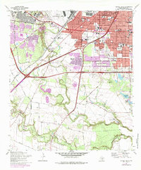
1967 Map of Terrell Wells
USGS Topo · Published 1975About this map
San Antonio expands southward in this survey, showcasing the mid-century suburbanization of Terrell Wells and Palo Alto Heights. The landscape is defined by the confluence of Leon Creek, Indian Creek, and the Medina River, where the terrain transitions from dense residential blocks and school districts like Columbia Heights to the industrial and military presence of Kelly Air Force Base and Lackland Afb. Notable for its genealogical value, the map identifies the Hernandez Cem near Garza Crossing and the Lona China Cem to the east, reflecting the area's deep-rooted ranching and farming history before the encroachment of modern infrastructure. An extensive Aqueduct and the Leon Creek Powerplant highlight the utility systems supporting the city's growth, while the Southern Pacific and Missouri Pacific rail lines intersect at Withers and Heafer, maintaining the region's role as a vital transportation corridor.
Find a feature on this map
61 named features on this map. Tap any name to fly to it.
Don’t see what you’re looking for? This feature index may not catch every label — zoom into the map to look around manually.
Map Details
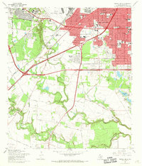
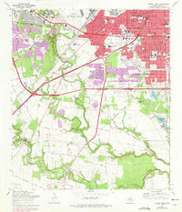
Editions of this 1967 Terrell Wells Map
3 editions found
Other maps of this area

1953 · Culebra Hill
USGS Topo · 1:24,000

1953 · San Antonio West
USGS Topo · 1:24,000

1953 · San Antonio East
USGS Topo · 1:24,000

1953 · Terrell Wells
USGS Topo · 1:24,000

1953 · Macdona
USGS Topo · 1:24,000

1953 · Southton
USGS Topo · 1:24,000

1954 · San Antonio
USGS Topo · 1:250,000

1957 · San Antonio
USGS Topo · 1:250,000

1958 · Losoya
USGS Topo · 1:24,000

1958 · Somerset
USGS Topo · 1:24,000