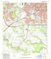
1992 Map of Terrell Wells
USGS Topo · Published 1992About this map
San Antonio expands southward in this early 1990s study, where established neighborhoods like Columbia Heights and Terrell Wells meet the industrial and military infrastructure of Bexar County. The landscape is dominated by the sprawling presence of Lackland AFB and Kelly Air Force Base, buffered by large-scale utilities such as the Leon Creek Powerplant and an extensive Sewage Disposal system.
Find a feature on this map
91 named features on this map. Tap any name to fly to it.
Don’t see what you’re looking for? This feature index may not catch every label — zoom into the map to look around manually.
Map Details
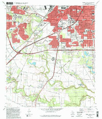
Editions of this 1992 Terrell Wells Map
2 editions found
Other maps of this area

1953 · Culebra Hill
USGS Topo · 1:24,000

1953 · San Antonio West
USGS Topo · 1:24,000

1953 · San Antonio East
USGS Topo · 1:24,000

1953 · Terrell Wells
USGS Topo · 1:24,000

1953 · Macdona
USGS Topo · 1:24,000

1953 · Southton
USGS Topo · 1:24,000

1954 · San Antonio
USGS Topo · 1:250,000

1957 · San Antonio
USGS Topo · 1:250,000

1958 · Losoya
USGS Topo · 1:24,000

1958 · Somerset
USGS Topo · 1:24,000