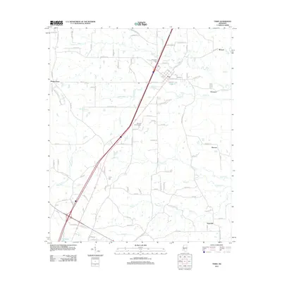
2012 Map of Terry
USGS Topo · Published 2012About this map
Terry serves as the primary hub of this Mississippi landscape, positioned where the I 55 W Frontage Rd and local thoroughfares like Georgetown Rd converge. The town's historical depth is evident in its proximity to the Benevolent Society Cem and Terry Cem. Further south, the landscape transitions into a network of agricultural lands and creek drainages, including the headwaters of White Oak Cr and Chestnut Cr.
Find a feature on this map
109 named features on this map. Tap any name to fly to it.
Don’t see what you’re looking for? This feature index may not catch every label — zoom into the map to look around manually.
Map Details
Editions of this 2012 Terry Map
This is the sole edition of this map. No revisions or reprints were ever made.
Other maps of this area

1903 · Jackson
USGS Topo · 1:125,000

1906 · Florence
USGS Topo · 1:62,500

1908 · Florence
USGS Topo · 1:62,500

1937 · Terry
USGS Topo · 1:48,000

1943 · Terry
USGS Topo · 1:62,500

1953 · Natchez
USGS Topo · 1:250,000

1955 · Jackson
USGS Topo · 1:250,000

1956 · Natchez
USGS Topo · 1:250,000

1959 · Natchez
USGS Topo · 1:250,000

1961 · Jackson
USGS Topo · 1:250,000