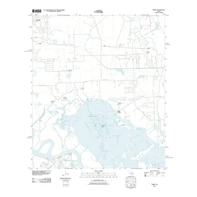
2010 Map of Terry
USGS Topo · Published 2010About this map
The low-lying wetlands of Jefferson County define this landscape along the Neches River, where industrial infrastructure and historical settlements meet the coastal bayous. The map captures a transition from the residential growth of Vidor and the community of Terry in the north to the extensive marshlands and water bodies of the south, including Grays Bayou and Bird Island Bayou. This area is shaped by its energy economy, dominated by the North Port Neches Oil and Gas Field and the Bessie Heights Oil and Gas Field, which are threaded into the environment near Gum Island. Genealogists will find several family-named burial sites documented across the terrain, such as Stephenson Cemetery, Thomas Cemetery, and Williams Cemetery. The local transport network, including FM 1442 and S Mansfield Ferry Rd, illustrates the necessary connections across these intricate waterways and gullies.
Find a feature on this map
44 named features on this map. Tap any name to fly to it.
Don’t see what you’re looking for? This feature index may not catch every label — zoom into the map to look around manually.
Map Details
Editions of this 2010 Terry Map
This is the sole edition of this map. No revisions or reprints were ever made.
Other maps of this area

1926 · Terry
USGS Topo · 1:24,000

1926 · Lakeview
USGS Topo · 1:24,000

1926 · Vidor
USGS Topo · 1:24,000

1926 · Texla
USGS Topo · 1:24,000

1926 · Mauriceville
USGS Topo · 1:24,000

1932 · Beaumont
USGS Topo · 1:62,500

1932 · Port Arthur NE
USGS Topo · 1:31,680

1943 · West of Greens Bayou
USGS Topo · 1:24,000

1943 · Orangefield
USGS Topo · 1:24,000

1943 · Mauriceville
USGS Topo · 1:24,000